Duke and more Ponzi dreams

Duke and more Ponzi dreams

Duke Photography building
Duke sign
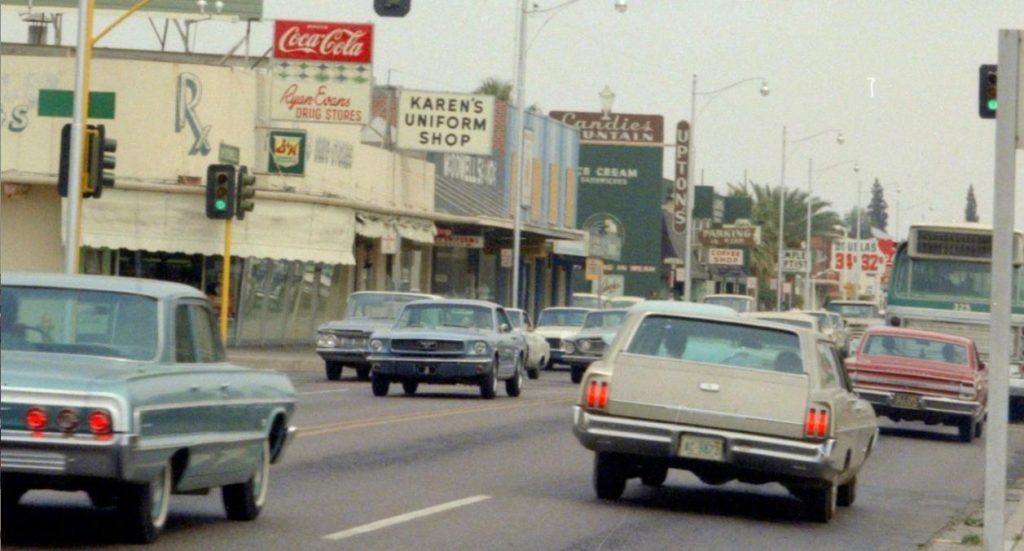
The news from my old 'hood is the pending demise of the Duke Photography building on the southwest corner of Seventh Street and Thomas. The Arizona Republic reported the building is set to be demolished and a Raising Cane's Chicken Fingers drive-thru built on the site. Duke is moving to the First Federal Building on Central in Midtown, taking its sign with it.

This is wrong for so many reasons, no wonder nearby neighborhood associations are opposing it ahead of a June 17th virtual public hearing. One big concern is increased traffic, including dangerous turns on Seventh, which has been widened and had "suicide lanes" added for rush hour. A Kentucky Fried Chicken drive-thru on the northwest corner already causes collisions.

Beyond that, while the building is modest it fits into the remaining fabric of the streetscape. The Raising Cane would be another soulless off-the-shelf building, made for cars not for pedestrians. If the company really wanted to be a good neighbor, as it claims, it would build something appropriate to the nearby historic districts. Too many losses have already been allowed, notably the replacement of John Sing Tang's iconic Helsing's at Central and Osborn — right up to the street — by a Walgreens, set back by a surface parking lot and surrounded by a low wall, gravel, and rocks.

Downtown’s pivotal 1970s

Downtown’s pivotal 1970s

Downtown1969
Between the long series of civic missteps that murdered downtown Phoenix and its recent rebirth of sorts, the 1970s loom large. As the decade began — shown in the photo above — much of corporate Arizona and the energy of the city had shifted to Midtown

The city opened the brutalist Phoenix Civic Plaza (so named because the Phoenix Civic Center was at Central and McDowell with the library, art museum, and "little theater"). The new complex offered a convention center, Symphony Hall, and sun-blasted open space. It was intended to revive downtown, but its "super blocks" destroyed the fine-grained, human-scale of the old urban fabric, including much of the Deuce. That fabric was characterized by eight or nine steps between doorways to shops or offices shaded by awnings.

Walter Bimson of Valley National Bank gave downtown a vote of confidence, insisting the new headquarters tower be build there rather than at Central and Osborn. The other big banks followed. Two new hotels were also built. But it was a catastrophic 10 years for historic preservation. The gallery below tells some of the story. Click on a photo for a larger image.

Civic_Plaza_rendering_Monroe_2nd_St_looking_southeast_1970

A rendering of Phoenix Civic Plaza. The shade trees in the foreground of Symphony Hall never happened, leaving an uninviting frying pan. It did show the concert hall's signature lobby chandeliers to advantage, lost now to the new Convention Center.

Early Phoenix mapped

Early Phoenix mapped

One of the most interesting sources of information on early Phoenix can be found on the Library of Congress' Sanborn Fire Insurance Maps. The Sanborn Map Co. produced detailed maps of 12,000 U.S. cities and towns, detailing not only buildings but in many their construction materials so insurers could assess their risks.

Below I have some views of Phoenix, one in 1911 and the remainder from 1949, focused on Union Station and the Warehouse District. Click for a larger image.

Sanborn block 77 1911

Sanborn Warehouse 1

6a00e54ee025588834026bdecd130d200c

Russell Lee’s Phoenix

Russell Lee’s Phoenix

512px-Russell_LeeIn 1940, photographer Russell Lee visited Phoenix. His main task was taking pictures of Farm Security Administration projects in the city. He joined such distinguished federal photographers as Dorothea Lange and Arthur Rothstein.

The FSA was created in 1937 to help ease rural poverty. Among its signature Phoenix operations were Camelback Farms, northeast of downtown and intended to create a stable environment for displaced farm families, and the United Producers and Consumers Cooperative, with about 12,000 members, mostly farmers.

But the trip yielded much more, including some iconic images of Phoenix as the Great Depression was loosening its grip and war was looming. Born in Ottawa, Illinois, in 1903, Lee died in Austin in 1986. 

I've written about Phoenix in the 1940s here. Below is some of his work from the Library of Congress. Click on an image for a larger view.

Sign outside Phoenix 1940

Welcome sign outside of town, with the meeting days, times, and places of service clubs.

Central and Phoenix 1940

Central and Washington, with Lerner Shops, movie theaters, and streetcar tracks.

Cactus Streetlight 1940

The famous saguaro streetlamp across from the Hotel Westward Ho. Only one was made, outside the Chamber of Commerce.

‘See me AZ’

‘See me AZ’

McDowell_10St._1960
This is the name for a new campaign to reduce pedestrian and bicyclist deaths on the streets of metropolitan Phoenix. As KTAR reported, “ 'See Me AZ' aims to educate people on research that indicates most crashes occur when drivers, cyclists or pedestrians don’t see each other."

I'm not hopeful.

However it's counted, Phoenix and Arizona rank high among the most deadly places for pedestrians. Fifth worst in the nation in 2018, according to the Governors Highway Safety Association. Deaths totaled 106 for the first six months of 2020 (Colorado 39; Washington 47). The federal Traffic Safety Administration ranked us fourth worst in 2018. A compilation by the Arizona Republic found a stunning 1,202 pedestrians killed by motorists between 2014 and 2019.

From the late 1940s onward, Phoenix streets were widened, especially to move vehicles quickly out of downtown (collateral damage was the loss of thousands of real shade trees). McDowell Road, shown above in the 1960s, is now two lanes or wider. This remains one of the scariest avenues for pedestrians or watchful drivers, especially between 56th Street and 24th Street, where the night swallows the inadequate illumination from too few street lamps.

The result today is that metropolitan Phoenix is a collection of real-estate ventures connected by wide highways called "city streets." Where Thomas Road crosses Central, it's about twice as wide as a major downtown street in Seattle. The "walk" signal lasts barely long enough to accommodate those wishing to cross and drivers frequently turn without looking. On any given day or hour, the Phoenix Fire online regional dispatch log shows "962 w. pedestrian" (a 962 is the radio code for auto collision with injuries).

Police and fire in early Phoenix

Police and fire in early Phoenix

Henry Garfias
Henry Garfias, the son of a Mexican general, was elected Phoenix's first town marshal in 1881. Already famous for apprehending the stagecoach "ghost bandit" as a county deputy, Garfias (above, courtesy of Duran Lugo) was said to have shot dead several outlaws as marshal and brought order to Washington Street's Whiskey Row (16 saloons and four dance halls). Thus was born the Phoenix Police Department.

The department operated out of the old City Hall until it received a more modern space in the City-County Building in 1929. Call boxes were used throughout the city for officers to check in. Phoenix equipped its squad cars with radios in 1932. You can learn more about PPD's history from the Phoenix Police Museum, located in the 1929 Police Headquarters at 17 S. Second Avenue. My new novel, City of Dark Corners, is set in the Depression-era department.

The Phoenix Fire Department came from passage of a bond issue in 1886 to establish a volunteer fire service with modern equipment and an improved water supply. Still, two hose companies (one Anglo, one Hispanic) competed until Frank Czarnowski joined them together as the Phoenix Volunteer Fire Department in 1888. By 1922, it was a paid, full-time department.

Here are some early photos (click for a larger image):

Nott steam fire engine

A Nott steam fire engine, one of Phoenix's first (City of Phoenix).

Fire_Station_horses_1st_St_Jefferson_1908_SHR copy

Horse-drawn apparatus at Fire Station No. 1, First and Jefferson streets, in 1908 (McCulloch Bros. Collection/ASU Archives).

Locked and loaded

Locked and loaded

IMG-3459

Carl Muecke illustration

America's, er, national conversation follows a predictable trajectory every time some psycho shoots up a place leaving multiple innocents murdered.

From the media and everyplace to the left of center: Finally we'll get gun control! Why does anyone need a gun, much less an assault rifle?!? America is the only country where anywhere near this level of Gun Violence happens! What was the motive — white supremacy, systemic racism? Why can't we have a leader like New Zealand's Jacinda Ardern, who quickly implemented strict gun control after the 2019 shootings in Christchurch?? Don't dare send 'thoughts and prayers' when we need to be passing legislation! The Second Amendment is about the states' militia, not an individual's right to own a gun!

From the right: Mostly crickets (except for this National Review broadside). And except at election time, when the prospect of Democrats "taking away their guns" makes the right vote for the likes of Donald Trump.

Then we go back to the status quo ante until the next mass murder, forget, and the cycle repeats. If we can't get even modest gun restrictions after Las Vegas (58 innocents murdered) in 2017, Orlando (49) the year before, Virginia Tech (32) in 2007, and Sandy Hook Elementary School (26, including 20 children) in 2012, it ain't gonna happen.

Toward a desert aesthetic

Toward a desert aesthetic

Tucson barrios
Once upon a time defining beauty in Phoenix was relatively easy. The old city was shady, grassy, and well landscaped. From there moved circles of citrus groves, flower fields, pastures, and farms in one of the most fertile alluvial river valleys in the world, and finally stark beauty and abundance of plant and animal life in the wettest desert in the world. No other city looked like Phoenix. It was magical and lovely.

Now this is largely gone. Even in the historic districts ahistorical desert landscaping is creeping. For most of the metropolitan area, built an acre an hour, the look is concrete, asphalt, gravel, and shadeless palo verde trees. Oh, and "shade structures" that provide little shade. Lookalike faux Tuscan tract houses in "master planned communities" offer postage-stamp lawns and wide driveways (the old driveways in Willo were two strips of concrete). Tens of thousands of shade trees have been felled, whether by diktat of the Salt River Project or to create the six-lane-plus highways called "city streets."

Curiously, these single-family houses are built on the same layout as most American homes. But with gravel instead of a lawn. No wonder the temperature has risen 10 degrees over the past 50 years and the summers last longer. When I was given a tour of Verrado — where David Brooks saw the future — the developers bragged how they had copied Palmcroft, for that was the kind of living their surveys showed buyers wanted. But it doesn't work, for this sunblasted development in Buckeye lacks the real Palmcroft's beautiful trees, grass, hedges, and flowerbeds.

Rural scenes of old Phoenix

Rural scenes of old Phoenix

Before "master planned communities," freeways, gravel, palo verdes, and endless pavement, Phoenix was closely surrounded by groves and farms, shade trees and virgin desert. It lasted until the 1960s and 1970s. I remember my grandmother taking me for a picnic on a dirt road surrounded by fields and beneath a cottonwood tree. Here are a few of the photos (click for a larger image):

Country_Road_Salt_River_Valley_1909(1)

Central and Southern 1930

Arizona willows or ash trees line Central and Southern avenues, 1930 (McCulloch Bros. Collection/ASU Archives).

Central and Southern 1930.jpg

Another view of shady Central at Southern in 1930 (McCulloch Bros. Collection/ASU Archives).

LincolnDriveWestof ScottsdaleRd_1935

Lincoln Drive west of Scottsdale Road in 1935.

Orangewood Ave. 1939

Orangewood Avenue in 1939 (McCulloch Bros. Collection/ASU Archives).

Degrading by degrees

Degrading by degrees

Glendale CC
When the Republican-controlled Legislature isn't busy with voter suppression laws or bills to further the National Rifle Association wish list, it can still make time for brilliance such as this: Allowing community colleges to award four-year degrees.

Legislation to make this possible has passed the state House, the furthest it's gotten in years of being repeatedly introduced. It might pass the Senate. Moving the proposal this far required compromises with the Board of Regents. As Howard Fischer of the Capitol Media Service reported:

The colleges can’t just get into the business. Instead, it requires studies to determine if the colleges, supported largely with local tax dollars, can hire the necessary faculty and sustain the programs. There also has to be a determination that the degrees offered will meet needed fields and whether they would “unnecessarily duplicate” programs already offered elsewhere. And there’s no authority for new property taxes.

There’s an extra hurdle in HB 2523 for the colleges in Pima and Maricopa counties. They could initially offer only a limited number of four-year degrees, defined as no more than 10% of total degrees offered for the first four years and 15% for years five and beyond.

The new pintos

The new pintos

129722237_10158722309756206_3960732349828115677_n
I operate the Arizona History Shop for journalists, amateur historians, and curious civilians — free and an email or phone call away. It's sometimes shocking how little Arizona's millions know about their (mostly adopted) state. The situation is even more startling with the East Coast media.

Today's exhibit is a story in the New Republic. Headline: "Arizona’s Democratic Senators Are Already Angering the Left." Subhed: "The activists who sent Mark Kelly and Kyrsten Sinema to Washington aren’t happy with their early moves in office." Kelly and Sinema voted for an amendment that would prohibit undocumented immigrants from receiving pandemic stimulus checks. TNR reports:

Latino advocates aren’t happy about it. “We are extremely disappointed by the vote that they have taken to strip stimulus funds from immigrants in the Covid stimulus bill,” Hector Sanchez Barba, executive director of the Phoenix-based group Mi Familia Vota says. “So we are sending a clear message, early in the game with a new administration, that this is unacceptable. We immediately mobilized our people on the ground, we immediately reached out, but we’re going to use all the political capital that we have. We’re going to use everything that we’ve been building in terms of political power to keep all the politicians accountable.”

Mac

Mac

48385338_2312414719014622_7917882964497661952_o
When today's Arizonans think about the state's most important U.S. Senators, they go to Barry Goldwater and John McCain. A few will remember Carl Hayden, one of the longest-serving members of the Senate and, after the assassination of President John F. Kennedy, third in the line of succession to the White House.

Yet Goldwater, although the father of the right-wing takeover of the Republican Party, had a thin layer of legislative accomplishments, and McCain did almost nothing for the state he made his home. Hayden was undeniably the most important figure in winning the Central Arizona Project in Congress.

The Arizona Senator who casts the longest shadow of accomplishments is nearly forgotten: Ernest McFarland. First elected in 1940 when he defeated incumbent Henry Fountain Ashurst, Mac was an important partner with Hayden in fighting for Arizona's share of Colorado River water. His most significant accomplishment was sponsoring the GI Bill, which provided benefits for returning benefits for returning World War II veterans, including educational benefits.

Mac was the father of the GI Bill. He also served as Senate Majority Leader from 1951 to 1953, followed by Lyndon Johnson.

Supersized

Supersized

Mesa_Main_St_Macdonald_looking_northeast_1940s

It's difficult to find another major metropolitan area where most of the suburbs are as populous as in Phoenix.

Consider: The "town" of Gilbert alone held more than 254,000 people as of 2019. It's only the fifth-largest municipality in metropolitan Phoenix, but larger than all but two cities in Los Angeles County: LA and Long Beach. Mesa is the 35th largest city in America, at more than 518,000 — larger than Cleveland, Cincinnati, St. Louis, Minneapolis and a host of better-known cities.

This is very different from the pattern in most metros. Older eastern and Midwestern areas consist of large numbers of small suburbs and a large center city. That star may have dimmed, as in Detroit or St. Louis, but none of their planets are anywhere close on population. The same is true in Atlanta, with a relatively small city of 507,000 in a metro of 6 million, but no individual suburb comes close. Charlotte, the 15th most populous city in the country (886,000), essentially annexed its entire county.

Phoenix's populous suburbs weren't always this way. These were once individual towns in the Salt River Valley, separate from each other, with different histories, dependent on agriculture and railroads. Above is Main Street in Mesa 1940, when the population was 7,200. This separation was evident well into the 1960s.