Van Buren Street east of 24th Street in the 1950s. Across the street is the State Hospital.
Between the glory days of the railroads and the completion of the Interstates, most visitors and newcomers to Phoenix arrived on the United States Highway System. Not for us the legendary muse Route 66 or the Lincoln Highway, the first transcontinental improved road that became U.S. 1, 40 and 50.
When the system was created in 1925 to standardize the many named highways that existed, Phoenix probably had a population of 35,000. It was isolated and difficult to reach, with formidable mountains to the east and north and forbidding desert to the west. Phoenix's coveted agricultural produce was shipped by refrigerated railcars. What Phoenix did eventually gain were U.S. 60, 70 and 80, along with U.S. 89.
U.S. 60 evolved from the many "auto trails" and plans for highways in the early 20th century, including the Atlantic and Pacific Highway. U.S. 70 joined it on the east at Globe. U.S. 80, which gained its own folklore history elsewhere in the country, came east from San Diego to also join U.S. 60 in Phoenix. In addition, U.S. 89 came north to Phoenix from Tucson. The map looked like this in 1950:

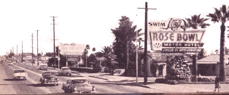
And all four U.S. highways converged on Van Buren Street, which for decades was the gateway to the city and lined with "auto courts" and motels, all set off with neon signs to lure weary travelers. The Sierra Estrellas Web site offers a detailed history of the many motels and Douglas Towne wrote an interesting meditation on Van Buren for Modern Phoenix. Another aspect of U.S. 60: It was the demarcation for the internment of Japanese-Americans during World War II. All living and farming south of U.S. 60 were interned, including those on Baseline Road.
With Van Buren being the repository of so much local highway history, two other gateways risk being forgotten: Grand Avenue and Buckeye Road. The WPA-built rail underpass on 17th Avenue south of the capitol shows the route where U.S. 80 separated from Van Buren, turned south and then west on Buckeye, which was also lined with small motels. Grand, the only diagonal in the young city's street grid, was another neon-lit boulevard carrying U.S. 60 to Los Angeles via Wickenburg and U.S. 89 to Prescott up terrifying Yarnell Hill.