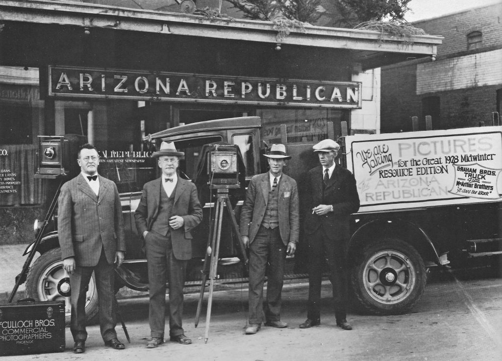
More shots in the ’30s and ’40s

A few days ago, we lost the Golden West Hotel, formerly the Steinegger Lodging House, at 27 E. Monroe Street and built in 1889. It held Newman's cocktail lounge as late as 2005. But even with all of Phoenix's losses, the preservation police could not save the oldest building in downtown. Duran Lugo documented this act of civic vandalism on Facebook's Phoenix Shadetree History page.
In memory, let me clear my desktop of some historic Phoenix photos that likely haven't been on this site before (click for a larger view)
. And a final thought: If the Golden West isn't safe, what about Union Station?
 This is Seventh Avenue looking north toward Osborn in the 1940s. The image perfectly captures old rural Phoenix, including abundant shade trees. No palo verdes of gravel to be seen.
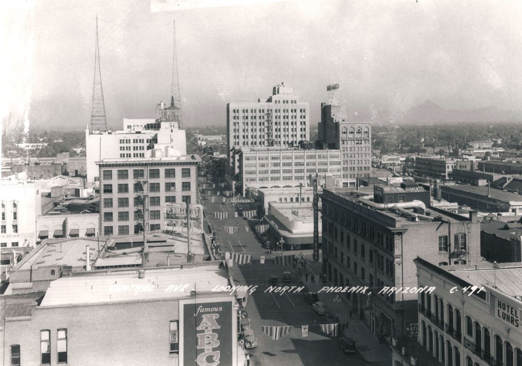
 Busy Central and Washington in the same decade. Unlike today's suburban feel, downtown looked like the business core of a real city.
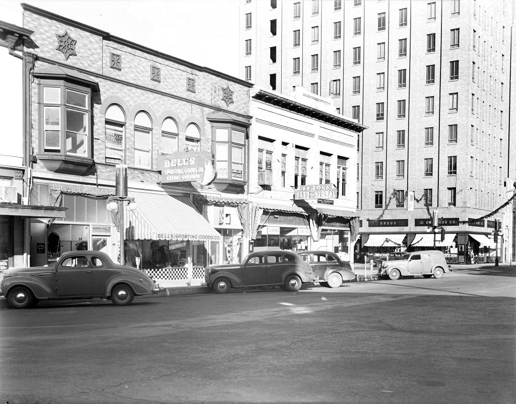
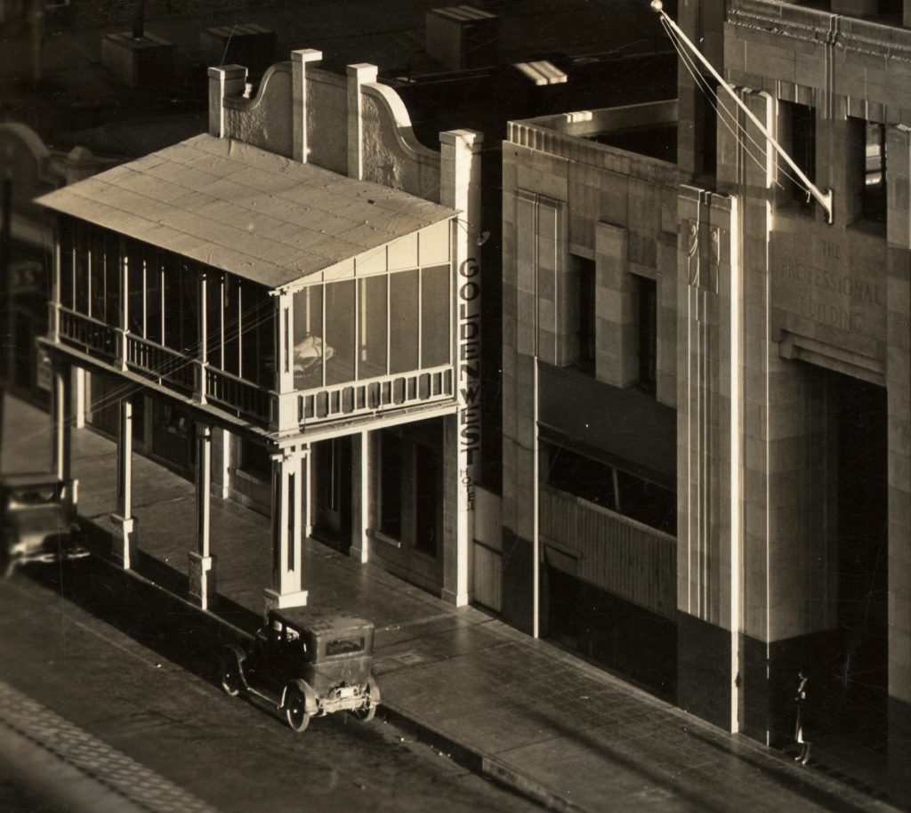
") Thanks to Brad Hall, here's a high-resolution shot from Monroe and Central looking toward the South Mountains in the '40s. Note the Santa Fe Railway ticket office in the Professional Building. A few steps farther to the left is the Golden West. South of the Professional Building is the Hotel Adams, demolished in the 1970s.
Thanks to Brad Hall, here's a high-resolution shot from Monroe and Central looking toward the South Mountains in the '40s. Note the Santa Fe Railway ticket office in the Professional Building. A few steps farther to the left is the Golden West. South of the Professional Building is the Hotel Adams, demolished in the 1970s.


")


")
")

")


")